

Commercial Property Imaging
A Clearer View of Your Commercial Property
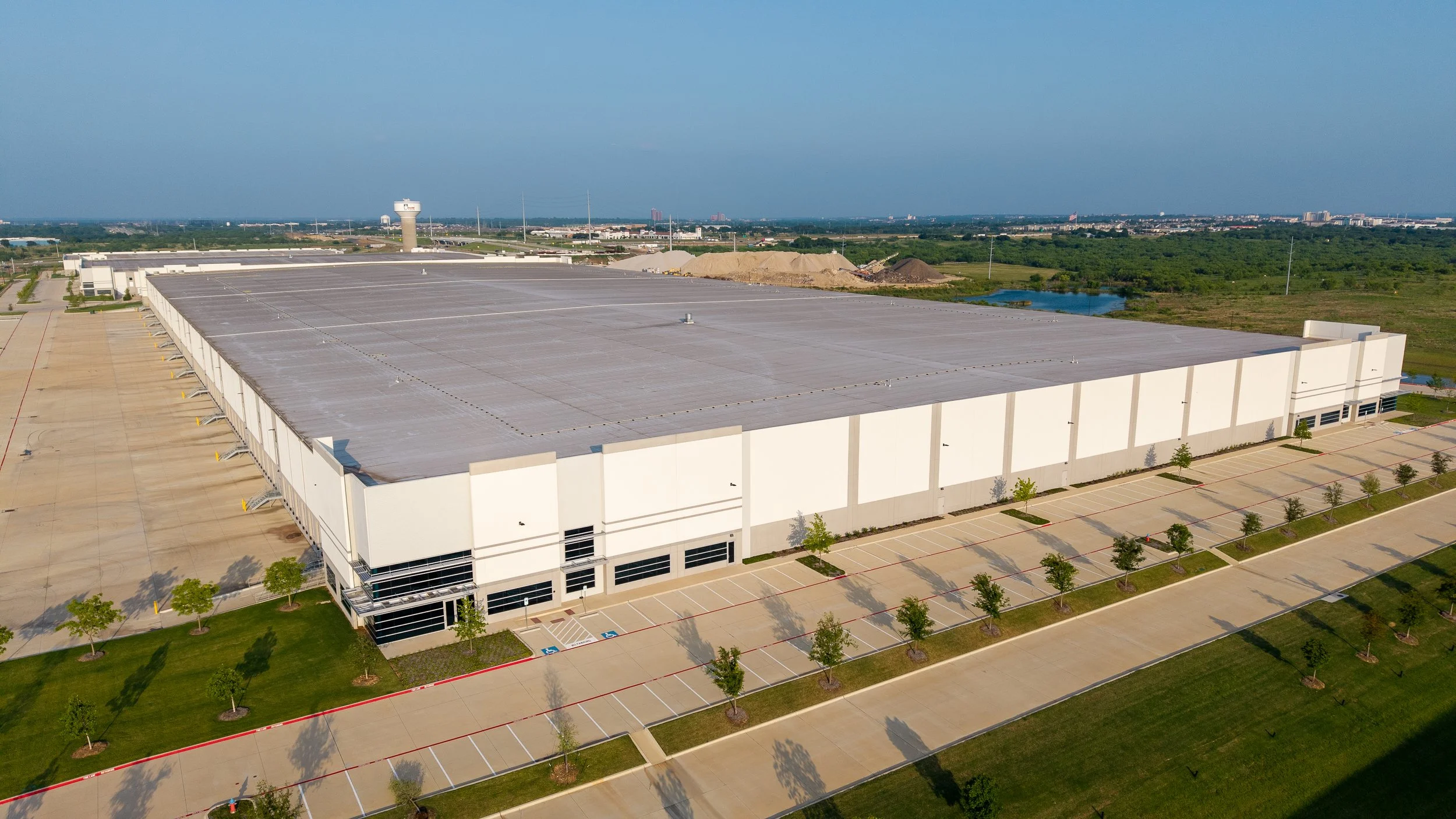
Professional aerial photography and video that showcase your property’s scale, access, features and surroundings—ready for websites, leasing materials, presentations and marketing.
Why Professional Aerial Imaging?
Show the Property Clearly—and Put the Imagery to Work
Professional aerial imagery does more than provide an attractive overhead view. It helps customers, tenants, investors and other stakeholders understand the property’s appearance, scale, access and surroundings—while giving your business versatile content for marketing and communication.
Present the Complete Property
Show buildings, entrances, parking, access routes, exterior features and the surrounding area in a clear visual context.
Strengthen Marketing and Leasing
Create professional imagery for websites, leasing materials, presentations, advertisements and social media.
Keep Visual Content Current
Update property imagery following improvements, tenant changes, seasonal transitions or other visible changes.
Why Professional Aerial Imaging?
Commercial Imaging Services
Choose focused property photography, a complete marketing collection or recurring coverage tailored to your business and property needs.
Aerial Property Photography
Professionally edited images showing the property’s buildings, entrances, parking, access, signage, scale and surrounding context.
Strengthen Marketing and Leasing
Purposeful aerial movement, polished editing, licensed music and business branding for websites, presentations and social media.
Interactive Aerial 360° Panoramas
An immersive overhead view that allows customers and stakeholders to explore the property and its surroundings.
Custom and Recurring Coverage
Flexible imaging for larger properties, multiple buildings, updated marketing content and regularly scheduled property documentation.
Commercial Imaging Services
Choose straightforward progress coverage, more comprehensive stakeholder-ready reporting, or a customized documentation program for larger and more complex projects.
Construction Essentials
Straightforward visual documentation for routine progress updates and individual project milestones.
• 8–12 edited aerial photographs
• Six repeatable progress viewpoints
• 2–3 short progress video clips
• Basic trimming and color correction
• Organized online delivery
• Three-business-day turnaround
Ideal for routine site updates and clients beginning an aerial documentation program.
Construction Progress Plus
Enhanced project coverage for reporting, stakeholder communication and a polished presentation of current progress.
• 20–30 edited aerial photographs
• 10–15 repeatable progress viewpoints
• 6–12 ground-level photographs when access permits
• 4–6 short progress video clips
• Edited 60–90-second progress video
• Site panorama and previous-visit comparisons
• 2–4-page PDF progress report
• Three-business-day turnaround
Ideal for active projects requiring comprehensive, shareable visual reporting.
Monthly, twice-monthly, and customized documentation schedules are available. Tell us about your site, schedule, and reporting needs, and we’ll recommend the appropriate level of coverage.
Custom Construction Documentation
A customized documentation program for larger sites, multiple work areas, executive reporting or specialized project requirements. The project-specific scope may include:
• Customized aerial and ground-level photography
• Project-specific viewpoints and flight paths
• Customized video deliverables
• Site panoramas and progress comparisons
• Expanded or executive-level reporting
• Multiple work areas and major milestones
• Specialized delivery requirements
Deliverables, turnaround and pricing are quoted according to project scope.
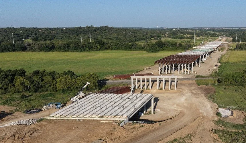
Earlier Construction Phase
Later Construction Phase
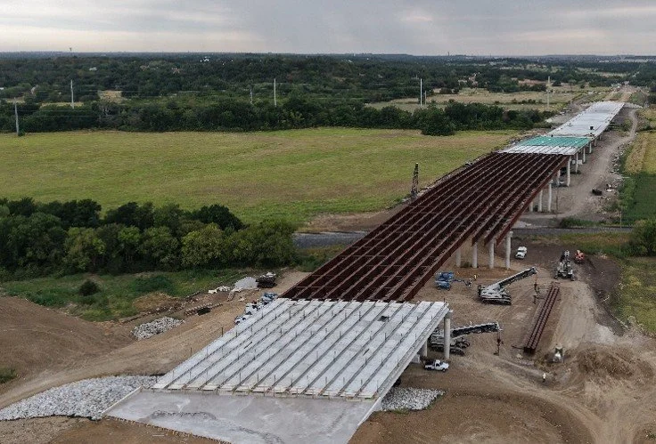
Consistent Coverage Throughout the Project
Recurring aerial documentation becomes more valuable when photographs and video are captured from planned viewpoints at consistent intervals.
A scheduled documentation program helps project teams:
• Compare visible progress between visits
• Maintain a consistent visual record
• Keep owners and stakeholders informed
• Document major activities and milestones
• Build an organized project history
Monthly, twice-monthly, and customized schedules are available. Recurring-plan pricing is available with a minimum six-visit commitment.
New Client Welcome Offers
Construction Essentials Bonus
Schedule your first qualifying Construction Essentials visit and receive a complimentary 360° site panorama.
The interactive panorama provides an immersive project overview that can be shared with owners, managers, and other stakeholders.
Construction Progress Plus Bonus
Schedule your first qualifying Construction Progress Plus visit and receive a complimentary six-image Project Marketing Photo Set.
These polished aerial or ground-level images can be used on websites, in proposals and presentations, and on social media.
Featured Construction Case Study
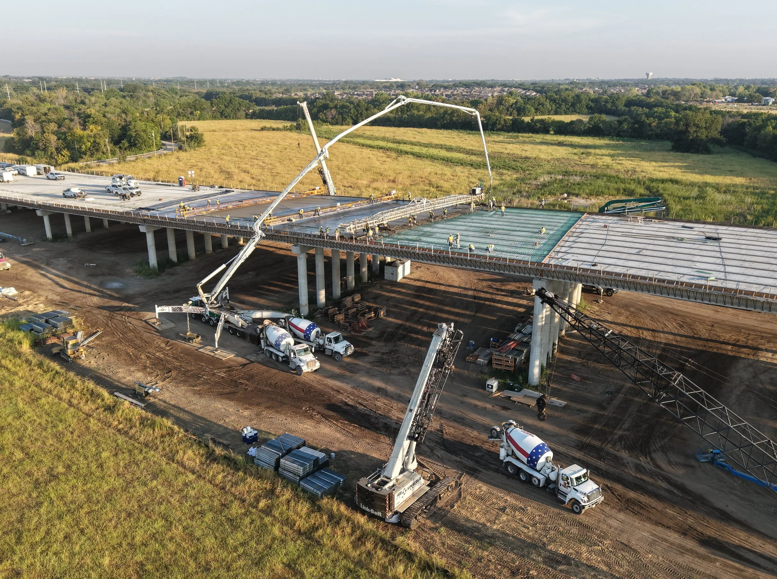
Hickory Creek Bridge Construction Progress
Denton County, Texas
This portfolio demonstration shows how aerial photography and video can document progress across an approximately 2,400-foot bridge project.
The coverage captures overall project scale, active concrete operations, equipment movement, and relationships between multiple work areas—details that can be difficult to understand from ground level alone.
The complete case study includes edited aerial photography, construction activity video, and a sample client-ready progress report.
Why High Country Aerials
✓ FAA Part 107 Certified
✓ Fully Insured
✓ Former Private Pilot
✓ 35+ Years Business Experience
High Country Aerials combines FAA Part 107-certified drone operations with more than 35 years of business, operations, and supply chain management experience.
Every flight is planned around your project's objectives—not simply to capture beautiful imagery, but to deliver visual information that supports communication, planning, and better decision-making.
From the first flight to final delivery, every project is approached with professionalism, reliability, and attention to detail.
Ready to Document Your Next Project?
Whether your project lasts a week or several years, High Country Aerials can provide consistent aerial documentation that keeps everyone informed.